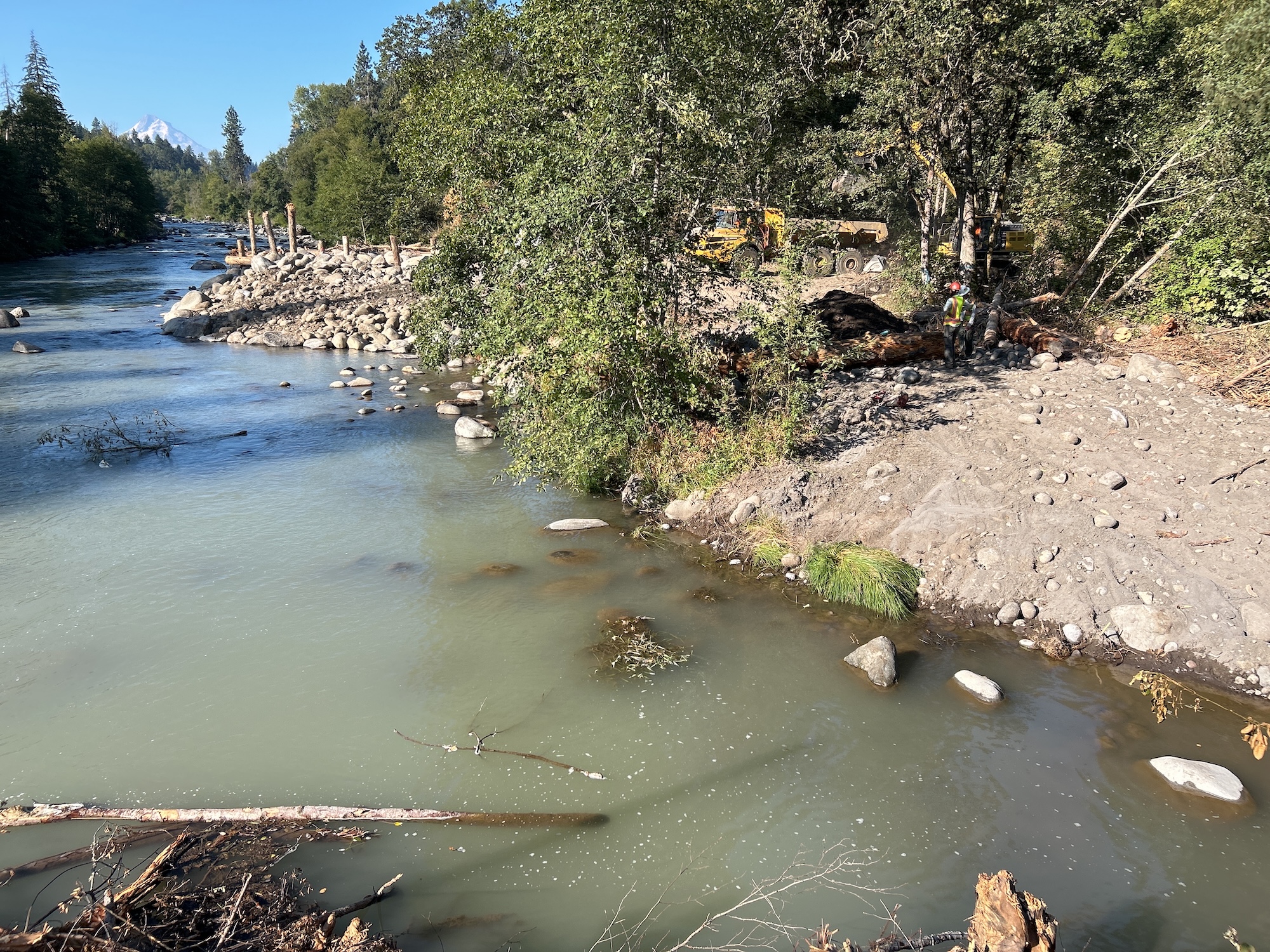
The Confederated Tribes of the Warm Springs and the Hood River Watershed Group lead River Mile 3 restoration project to improve fish habitat
Two new side channels will improve fish habitat in the Hood River, thanks to a recent restoration project led by the Confederated Tribes of the Warm Springs Reservation of Oregon and the Hood River Watershed Group. Columbia Land Trust has cared for this section of the river within our Powerdale property since 2013, following the removal of the Powerdale Dam in 2010. For years, we’ve been preparing with our partners to restore fish habitat at this site, which is located just below the former dam location and three miles up the Hood River from its confluence with the Columbia River.
The Hood River is home to an incredible diversity of fish species due to its location, fed by the glaciers of Mt. Hood and flowing into the Columbia River at the transition point between the east and west sides of the Cascade Range. Spring and fall Chinook salmon, Coho salmon, summer and winter steelhead, resident rainbow trout, sea-run and resident cutthroat trout, bull trout, Pacific lamprey, and many other resident fish species rely on this river. All the threatened fish species in the Hood River use or pass through the project reach at least once in their lifespan, making this a critical area for habitat restoration.
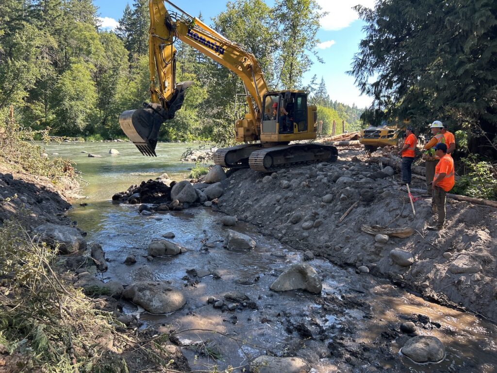
Completed over about eight weeks of construction in July and August, the project created a new perennial side channel that adds about 1/3 of a mile of fish habitat, as well as a new 2,400-foot seasonal channel that will activate during high flows. Together, the excavation of these new channels required moving about 11,000 cubic yards of materials.
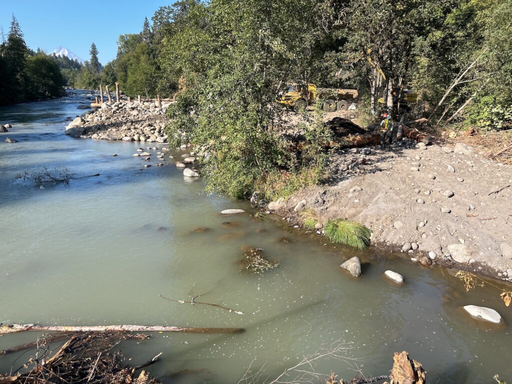
The new perennial side channel is about 25 feet wide at its base for most of its length. Salvaged boulders and wood structures were placed strategically to create pooling areas, reconnect the river with its historic floodplain, and provide important habitat features for salmon and steelhead at multiple life stages. Just upriver, the secondary channel will only fill during high-water events. This feature will slow down floodwaters by spreading the river across more of the historic floodplain. This benefits smaller fish like juvenile salmon and steelhead that would be flushed downstream by strong flows.
This seasonal channel connects to the top of the new perennial channel, and together they flow 1/3 of a mile downstream before flowing into previously scoured channels and rejoining the mainstem.
Two inlets were excavated to connect the river to the new perennial side channel. Two large wood structures anchored with boulders were constructed adjacent to the main riverbank, one on the downstream side of each inlet. These structures help direct a portion of the river’s flow into the side channel entrances and were designed to look and function like the natural log jams found on the upstream ends of nearby islands in the Hood River. The root wads that stick out from these structures provide cover for fish and help create deep pools where fish can hide from predators. “There is intention behind both the placement and the material of these structures,” said Javan Bailey, Project Manager for the Hood River Watershed Group.
The project was engineered by local river restoration firm, Inter-Fluve, Inc. and Aquatic Contracting implemented the design. The challenge was balancing the need to slow down and spread out the river’s flow across the floodplain while ensuring that the Hood River’s glacially-fed, silt and sand-laden waters won’t slow down too much, which would cause the river’s sediment load to drop out and fill the channel that was just created.
“Opportunities to pursue floodplain restoration like we’ve accomplished in this project are limited in the Hood River watershed,” said Matt Steinwurtzel, Fisheries Habitat Biologist and Hood River Restoration Project Manager with the Confederated Tribes of the Warm Springs Reservation of Oregon. “The River Mile 3 project exemplifies the great work that partners in the basin can accomplish when working together on behalf of fisheries. Because this project is located within the lower mainstem Hood River, these actions will benefit virtually all aquatic species that depend on the health of the watershed. The Hood River lies within the ceded lands of the Confederated Tribes of the Warm Springs. Through these efforts, not only are we addressing the key limiting factors to the recovery of winter steelhead, summer steelhead, and Spring Chinook salmon populations, but we are also ensuring that spring Chinook harvest opportunities remain available for Tribal members now and into the future.”
The lower section of the Hood River, including the River Mile 3 project site, has been impacted by hydropower development since at least 1923 when the Powerdale Dam and the accompanying pipeline were built. In addition to the dam itself, the development of roads, levees to protect the pipeline from flooding, and nearby railroads and bridges all confined the river to a single main channel, cutting it off from most of its former floodplain and side channels. This simplified the available aquatic habitat and removed fish-friendly features like gravel beds for spawning, slow-moving side channels where fish can escape strong flows, and deep, protected pools that provide cover from predators. The goal of the restoration work here is to restore those habitat features to this section.
“This project elevates Columbia Land Trust’s 13 years of site restoration and stewardship at River Mile 3 to the next level,” said Land Trust Conservation Easement Manager Kate Conley. “A decade ago, we completed an initial phase of floodplain reconnection here and now, thanks to our partners at the Hood River Watershed Group and the Confederated Tribes of the Warm Springs, we – and the fish! – will see the benefits of year-round flow through this historic floodplain. I can’t wait to see what these channels look like when water levels rise this winter.”
The end of construction is really only the beginning, as Columbia Land Trust will continue to steward this site, and there are years of re-vegetation, weed control, and monitoring ahead. “That is the challenge and the joy of this work,” said Conley. “Our job is never done, but sticking around for the long term means we get to witness improvements that nature makes over time after restoration gives the river more room to move.”